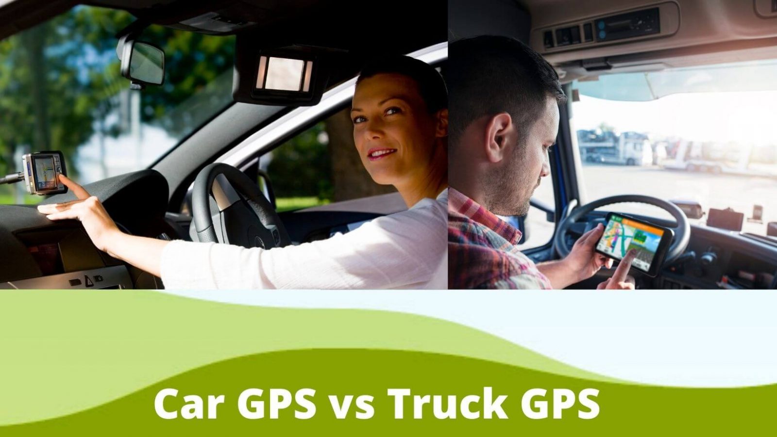
What is the difference between car GPS vs truck GPS?
Nowadays, GPS is becoming the most useful and fruitful technology for drivers. Whether you have a truck or car, this technology works like a miracle because it helps you reach your target destination without fear of getting lost. Beyond that, it helps you tracking different properties such as vehicle speed, direction, and course size. While the GPS uses are almost the same, but there is a slight difference between car GPS and truck GPS.
So, what are the differences between a car GPS and a truck GPS? The major variation you will find between those two is identifying the best route to the destination. The car GPS provides you the default map, whereas the truck GPS can discern some extra data beyond normal.
On the other hand, if you are a truck owner, you can’t benefit from this miracle invention unless you install the right GPS. Today, many fleet truck owners install the truck-specified GPS on their truck instead of their vehicle’s normal one. In the following, we will notify you what those differences are and why you need a specific GPS.
What does it mean by GPS, and how it works?
Precisely, the GPS navigation application is used to calculate the optimized route of the picking point and the destination point. Meanwhile, the information that will help a driver mostly, such as a restaurant, stop point, live road, and weather update, the fuel station-related information can be obtained from the GPS navigation system.
Put simply; the GPS application makes the driver’s risky job less stressful and more enjoyable. The provider’s provided database maintains the core mechanism of a GPS navigation solution. The app developer continuously updates their app’s database with some essential information that the driver mostly needs.
Here the information includes parking spots, rest stops, bridge-related information, weight & height limit, live road & weather update and many more. A GPS solution communicates with the GPS (Global Positioning System) using a telemetric system, phone, or navigation device to provide that information.
Pulse, by that way, the GPS navigation solution defines the truck’s live speed, location and direction-related information. Drivers are allowed to input their vehicle’s specifications and choose the destination before riding.
Then the navigation application provider uses the diver’s provided details and GPS data and starts calculating and then providing the most compliant and efficient route to reach the desired destination.
What is the difference between a car GPS and a truck GPS?
GPS is made to help you in getting the exact direction and route plan. When you install this device on your Car, you can safely go to your desired destination. Also, you can enjoy the following features while installing a GPS navigation system in your car.
- Providing clear path.
- Relief from stealing related tension.
Although the GPS functions the same way, but the trucker GPS offers some additional facilities beyond the car GPS offers. With this system, truckers can improve their experience, efficiency and safely reach the location on time. The features of trucking GPS navigation are including.
- Help to track the odometer.
- Notify the locations and diesel prices.
- Truck driver’s points of interest.
- Parking locations of the truck.
- Restaurant locations of the truck.
- Notify the traffic and weather-related real-time information.
- Bluetooth and connectivity capabilities.
- Notify the safe truck route based on size, weight and load.
- View, dispatch, update and dispatch the route,
While the regular or Car GPS navigation system offers some of those mentioned features, they can’t help you while you need to pass the road with a specific height and weight limit.
You may know some roads and bridges have weight or height limits that are extremely dangerous for the truck driver. If the truck doesn’t get notified before, they will be punished due to violating rules and regulations. Learn more here about how you can set GPS with a location.
What are the differences in amenities of a truck and car navigation solution?
The benefits of using a GPS in the car and the truck are given below.
Car Navigation Solution:
- Spot the vehicle’s location
The primary function of the car GPS tracker is to find out the vehicle’s location. It will give you a handful of benefits in some situations like, after going to the car parking, you can’t spot your Car easily. In this situation, the car GPS tracker will help you find out the Car.
- Getting emergency help
The car GPS tracker works well to help in an emergency quickly, suppose you are in an accident or stranded; you can tell the emergency workforce where you are situated precisely. It is most important when you are stranded in an unknown area.
- Keep Eyes on teens activities
The lacking of skill and experience could lead to any serious issue for your teen. In this arena, car GPS will help you significantly by monitoring teen’s activities.
- Get the location of the theft car.
Getting snatch a car is a regular phenomenon. Using a GPS tracker, you can locate your lost car location, and it will increase the chance to get it back.
- Notify your Car’s health
One of the key features of the car GPS is that it will notify you of the overall condition of your Car and remind you of the maintenance time.
Truck Navigation Solution:
- Lessen the route length
Every extra wheel rolling will charge you some additional money. Navigate in the wrong direction will consume more fuel, time and money, and that’s why an optimized route is necessary for the truck driver.
- Facilitate in on-time delivery
Every customer wants on-time delivery of their products. If your delivery man can’t spot the place, they will consume huge time that will affect your relationship and spoil your future business. The GPS navigation system can help significantly in this arena and make your customer happy.
- Driving safely
With the help of a GPS navigation system, you can spot the following things on the way:
- Low bridges
- Overpass
- Tight corners,
- Specific height and weight-related information of the bridge,
- Weather forecast,
- Live road news etc., and steep declines while driving a truck.
When you can spot any of those, you can make quick decisions related to speed.
- Help to follow the rules and regulation
By a truck-specific GPS navigation solution, you can know the speed and weight limit of the road. If you can’t follow those rules, you will be punished, of course. Also, you can customize your route plan with the rules and regulations.
- Notify on various updated information
The truck-specified GPS will notify you of some additional information beyond the normal. For example, bridge-related information, specific height and weight-related information of the bridge, weather forecast, et.
What apps do truck and car use?
A handful of applications are developed to make navigating easier by providing the necessary information to the drivers they require while driving. Many drivers install Google Maps and supplementary apps to make sure of the exact locations and approach.
Moreover, some apps have extra features to provide you additional information like restaurants, safe places to stop at night, real-time weather notification, and other drivers’ ratings.
Let’s introduce some of the best GPS apps that can be used in both the Car and the Truck.
- Waze
Waze comes to provide the most up-to-date information to the drivers using crowdsourcing. That information is on gas price, routes, restaurants, traffic, road closure and more. Waze helps in automatic rerouting to keep you on the right track to quickly reach the destination.
- PTV Navigator
Here is another best GPS app that offers some additional amenities to the truck driver.
Using its features, you will get route suggestions and updates based on weight, size, and other vehicles’ restrictions. Plus, this app is used in keeping the ELD up to date by tracking your mileage.
- CoPilot Mobile Navigation/CoPilot GPS
This trucker app offers its service in exchange for $9.99 monthly charges on iOS and Android devices. You can input your vehicle’s dimensions and weight before the start journey, and you can get a specific route based on the dimensions, shows rest stops, CAT scales and so on.
- Sygic
Sygic became one of the world’s most downloaded offline GPS navigation apps and obtained trust from more than 200 million drivers. It offers offline modes of all countries, updated maps, GPS navigation with voice-guided, interesting places, and walking directly through the pedestrian GPS navigation system.
- inRoute Route Planner
This app offers the best service to long drivers. You can easily find it on the App Store, and the charges are $14.99. The driver will get information regarding food and sleep, real-time information on road conditions and weather.
- Trucker Path
The trucker path offers services regarding weigh stations and the best rest stops, vehicle washing spots, nearby Walmarts, etc. Besides, you can get the best fuel prices and other users’ reviews to help you choose the smoothest and fastest route to your location.
- Google Maps:
We have nothing to say special on Google Maps because you are already familiar with it. However, it will provide you the latest information on restaurants, hotels and gas stations. Plus, you can share information with other drivers.
What is the best free Car and Truck GPS App?
Google Maps are a popular free GPS service provider app. With this app, the driver can see the location-related information that helps them make a plan. Plus, you can see the exact path having no complexity like a wrong turn or road with no way to get out.
Although you will benefit through the image and satellite map, you should bear in mind that Google Maps isn’t 100% accurate because it may have old satellite photos. Besides, Google Maps shows you the location of fuel, stop place, restaurants and so on. Apart from Google Maps, let’s see some other free apps in the following.
- Waze: It is a free crowd-sourced app. You can easily get it from the authorized source for your iOS, Android and Windows devices.
- DAT Trucker: This is another free available app on the Google Play Store for your Android device.
FAQ – Truck , Car GPS Sytem
Can you set Google Maps for trucks?
There is no way to set Google Maps for trucks, and you can’t set a trucker mode for Google maps. Instead of the Google Maps for trucks, you can use a trucking GPS navigation unit specially designed to drive a truck. However, after conjunction with the GPS unit, you will enjoy some excellent features.
What is the difference between Google Maps and GPS?
GPS or Global Positioning System is a USA government-provided service. This system is operated through satellite-based radio navigation. GPS in Electronics Device will help you receive location-related information in the nature of longitude, height, and latitude to an ellipsoidal Earth model.
To get such information, you don’t require an internet connection because it works through a radio navigation system. On the other hand, Google Maps demands an internet connection to provide its map-related service. This map service collects GPS locations to notify you of your location’s present and surrounding directions.
Can Google Maps avoid low bridges?
You will find good use of google maps in avoiding low clearance bridges. But sad to say, you don’t find all of the low overpass locations in the trucker’s atlas. When you want to see the potential problems of the best route on Google Maps, the street view will let you see the posted height.
How much does the trucker path cost?
The trucker path mentioned the device is free, and it charges $8.30 per month as the subscription fees. However, Renren Inc. owned this mobile application firm.
They announced that they are launching a low-cost ELD (electronic logging device) package. Under that package, you will get a free device, and the subscription fee is $8.30 per month.
Can I use Google Maps as a GPS?
Typically, on your Android device, you can use the Google Map app to find the direction of your desired destination. For that, you need to click on the Start navigation button, and then you will see a GPS navigation-style experience with a voice command.
The voice will give you turn-by-turn directions. However, the iPhone or iPad also allows you to install this Google Maps app and use it similarly.